Our civilization is built on science. Or at least, it ought to be. (Looking at you, Flat Earthers.)
Humans rely on the idea that we can perform experiments and make observations; record the resulting baseline information; and use those metrics and data down the road to make quality, data-rich decisions and benchmarks. It’s the basis of many aspects of our society, from selecting lumber for framing houses to designing a chip that you can’t eat just one of.
Data is usually a helpful way to make choices, including those regarding site selection decisions for clean energy projects. Whether you’re the demographic trying to develop a renewable energy source, gasworks, real estate, or anything else, good intel is the foundation of good decisions.
Unfortunately, there are several reasons data can fail. And because of this, project managers find that the traditional site acquisition process – as it stands today – usually isn’t the best one. If you want to make the most of data and ensure higher success rates when selecting potential sites for new construction, you’ve got to move past these hurdles and find a new methodology.
So why does data fail, and what can we do about it? Let’s dive in.
The Data Is Stored in Too Many Places
One of the most significant drawbacks to relying on disparate datasets is that sometimes it’s very difficult to find. Nowhere is this more true than in the case of area of interest selection, where you have to account for a veritable encyclopedia of variables – all stored in different offices, different files, different servers, and different … clouds? Who even knows where stuff is stored these days?!
Some people do, of course. But the average developer doesn’t have the time or the resources to check every local government office, courthouse records room, and online library to figure out whether or not a potential project parcel is viable.
Too bad you can’t move forward until that’s done. You can’t even worry about construction costs or labor costs yet, because you need permits to ensure the land doesn’t violate regulations regarding:
- Wetlands, watersheds, aquifers, rivers, waterways, or floodplains in the area
- Cultural and public lands, tribal sites, opportunity zones, or special regulatory districts
- Protected areas, endangered species, or wildlife corridors
- Soil, contour, slope, landslides, karst areas, faults, and other geological features
- Utilities such as substations, transmission lines, pipelines, power plants, mines, cell towers, hazardous facilities, or oil and gas plays
- Greenfield and Brownfield sites
Any of the above location factors might be tagged with a rule or regulation that disallows the site's development for any reason. Until you know what the information is, you can’t get the permit for it. And until you get the permit, you can’t move forward in your project timeline, even on the best sites.
You Can’t Get the Data in Time
Granted, with enough determination, effort, and biting one’s tongue, you can usually get all the information you need. Sometimes, though, the opportunity you had has evaporated by the time you do. Perhaps someone else has already bought the land, or your funding has dried up, or other stakeholders fell through due to strain and inactivity.
Whatever the cause, this happens all the time. Some developers we work with have told us that while environmental reviews usually take several months, that’s not always the case. Some take years … in one instance, almost a decade. You know that poor developer ate ulcers for breakfast every morning during that time- here come the healthcare costs.
.webp?width=1500&name=hourglass-%20AdobeStock_243769383%20(1).webp)
You Don’t Get the Correct Data the First Time
Too frequently, initial surveys tell you nothing more than what other tests are needed. You can’t simply walk onto a parcel of land, tick a few boxes, examine a few grass blades, and call it good. The data validation needed often takes many forms and must be gathered in multiple phases. Perhaps after an initial location analysis, you determine you need to:
- Test soil or groundwater for contamination and chemicals
- Take drillings and borings to learn more about the local geology and figure out whether the site can support the proposed structural load of a project
- Survey the land to determine if there are areas that can’t be paved or developed
- Find out whether there are any nasty surprises nearby, like an underground gas tank, and what to do about it
- Explore nearby crop circles and figure out how to communicate with the aliens that left them (hey, we’ve walked through a LOT of cornfields, okay?)
That’s not to say the data is bad or incorrect, only that you don’t necessarily get everything you need upfront, and it may lack information on prioritization. Again, you can lose out on opportunities you might otherwise have leveraged when that happens.
Delays Beget Delays
When you eventually do get the data, you’re often so behind the eight ball that you just can’t catch up. Waiting for months on information when you can’t control the timeframe usually means:
- Other information becomes outdated
- You lose buy-in from workers, partners, and third parties
- Your materials aren’t in the right place at the right time
Things Change
We know you know the only constant is change. Mainly because it’s what well-meaning jerks say when what they mean is, “this is sad, and I have no idea what to do about it, so I guess I’ll just say this instead.” Typically change requires you to get a new car because your old one is totaled or adapted to the neighbor who just moved in and plays deafening country music. To be fair, that’s hard for anyone.
What’s agonizing is when you’ve been waiting for months – or years – to get the information you need about a site you’re trying to develop, and you wait so long that the rules change in the meantime. This necessitates more surveys, checking, new permits, and further adjustments to the timeline and operating costs. It’s … a lot.
What’s the Solution? Let Us Tell You
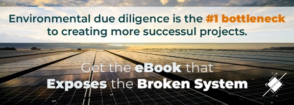
The bad news is that the above situations happen all the time. The good news is that every single one of the above problems can be solved by speeding up the risk analysis and environmental due diligence processes. After all, any data is good to have … so what do all the above have in common? You just can’t get the data you need in a timely fashion.
Transect has an answer for that. Our due diligence tools enable you to get the information needed for decision-making and permitting in mere minutes compared to days, weeks, months, and *shudder* even years. This is automated consulting driven by machine learning and algorithms. Want to learn more? Sign up for a demo today.