
Transect is bringing you exciting new solutions to discover and assess project sites in minutes.


Data Center Pulse

Risk Monitor
Petitions and social media posts in Transect Pulse

ERCOT withdrawal capacity estimates

Fiber optic lines and data center locations

Smart Sites (in beta)
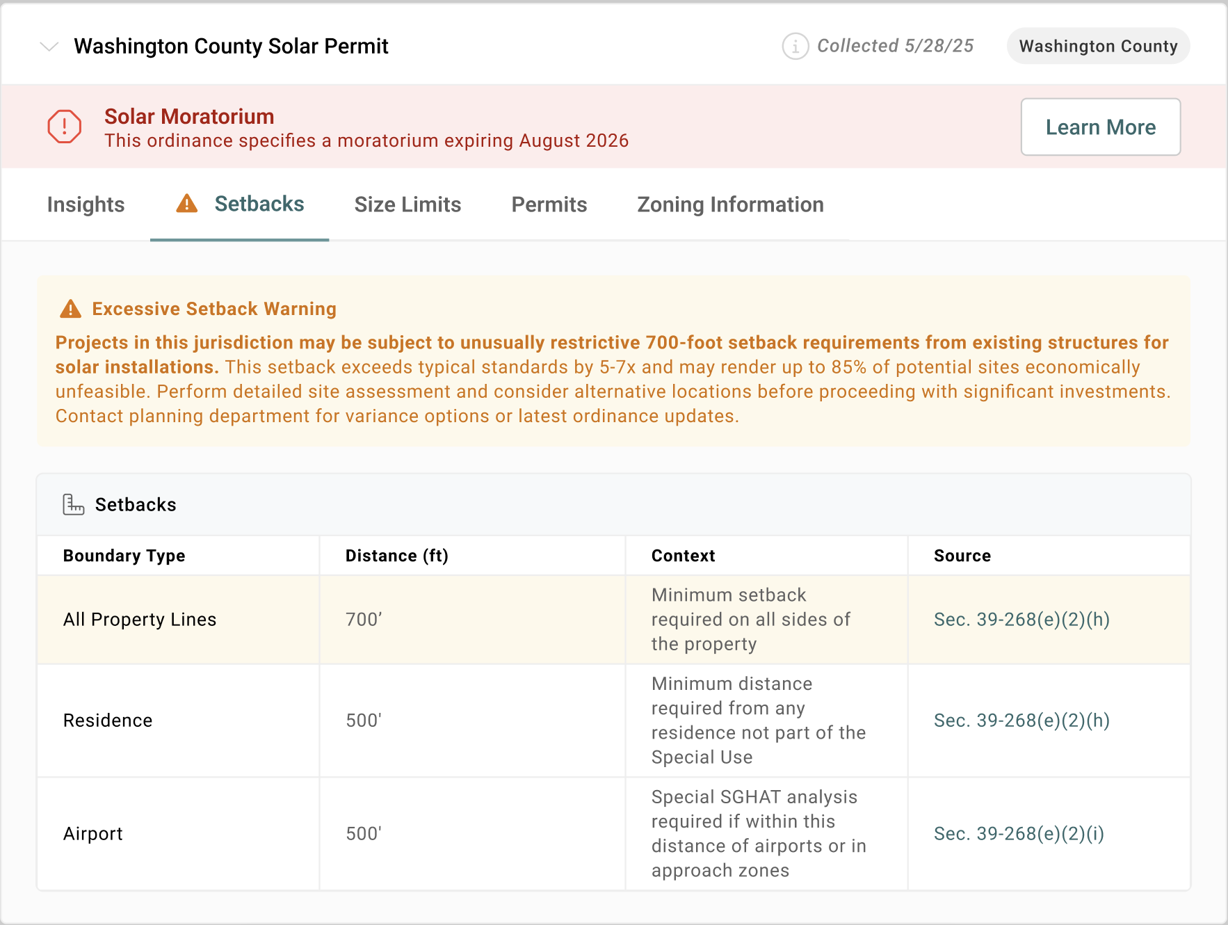
Local Solar Regulations
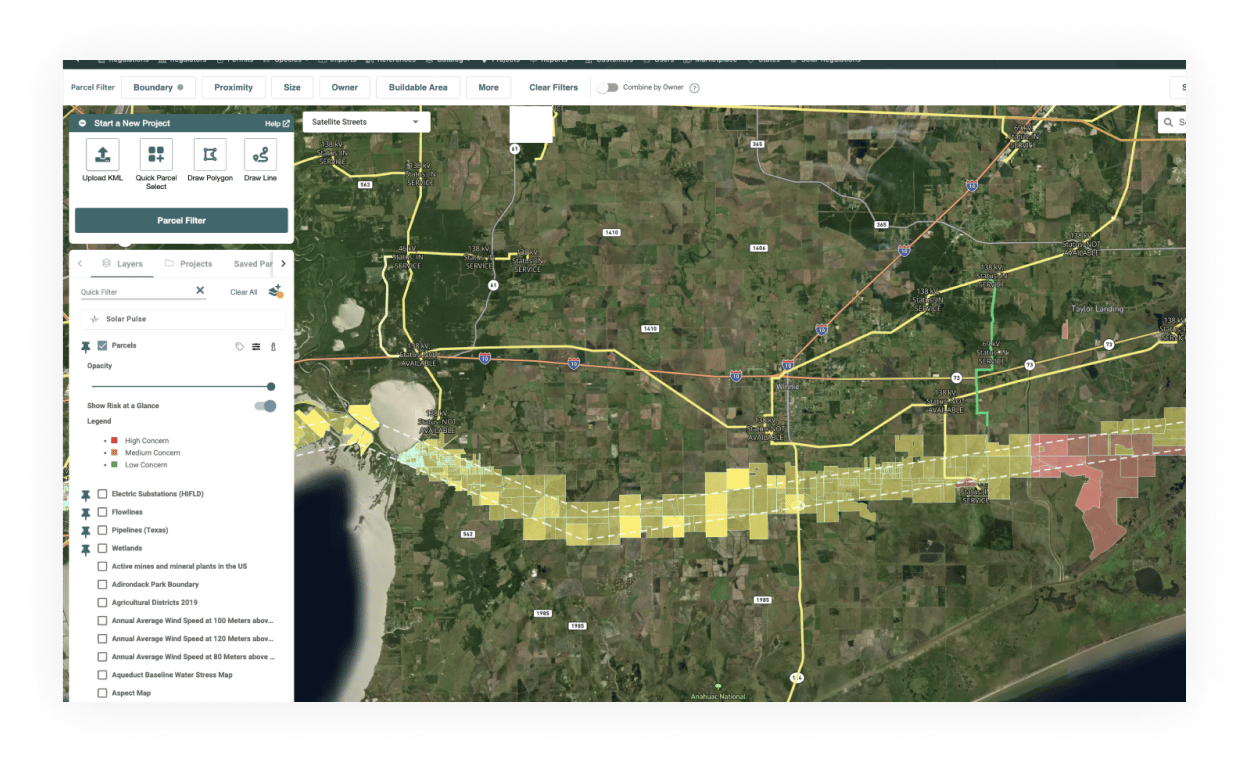
Transmission interconnection capacity
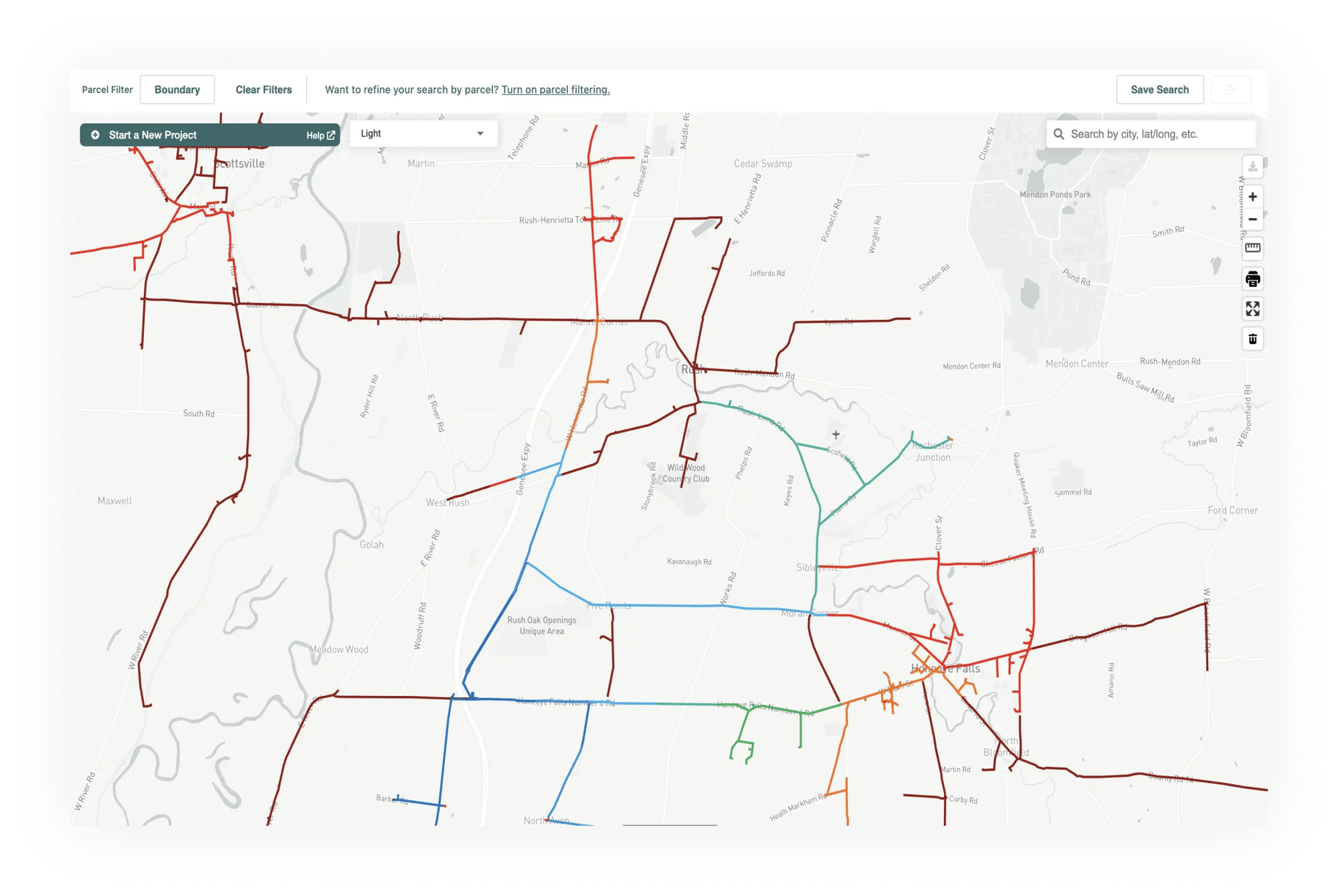
Distribution lines and hosting capacity
.webp?width=2000&name=Hosting%20Capacity%20(1).webp)
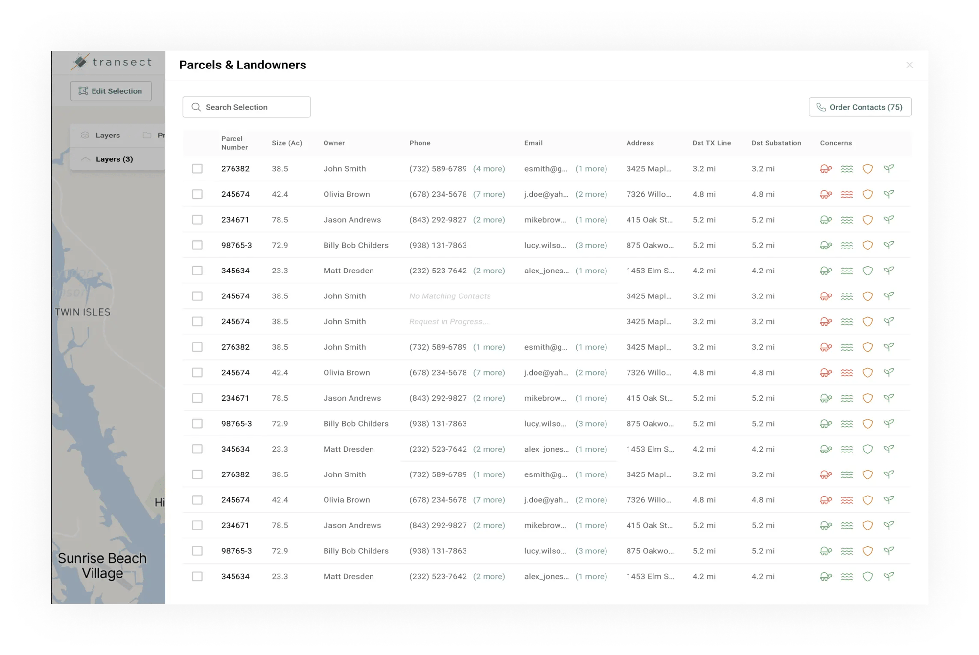
Landowner contact information
Transect Services Marketplace
.webp?width=2000&name=Line%20Capacity%20(2).webp)
Linear reporting for pipeline and transmission line projects
Keep discovering
Get your free mini-report
Curious how Transect can help you assess a parcel of land? Upload a KML and we’ll deliver a free mini-report today.

Get started with Transect
Selecting the best sites for your renewable energy projects is just a few clicks away.
