Skip to the main content.
Schedule a Demo Login

Ghost Waters: Ephemeral Streams

Free Permitting Checklist

Practical Tips to Avoid Environmental Risk on all Your Projects

Download our environmental permitting checklist to get a step-by-step list of ways to protect your project from the 9 most common environmental risks.

Download Your Checklist
ghost-waters-hero-2

Learn everything you need to know about ephemeral streams.

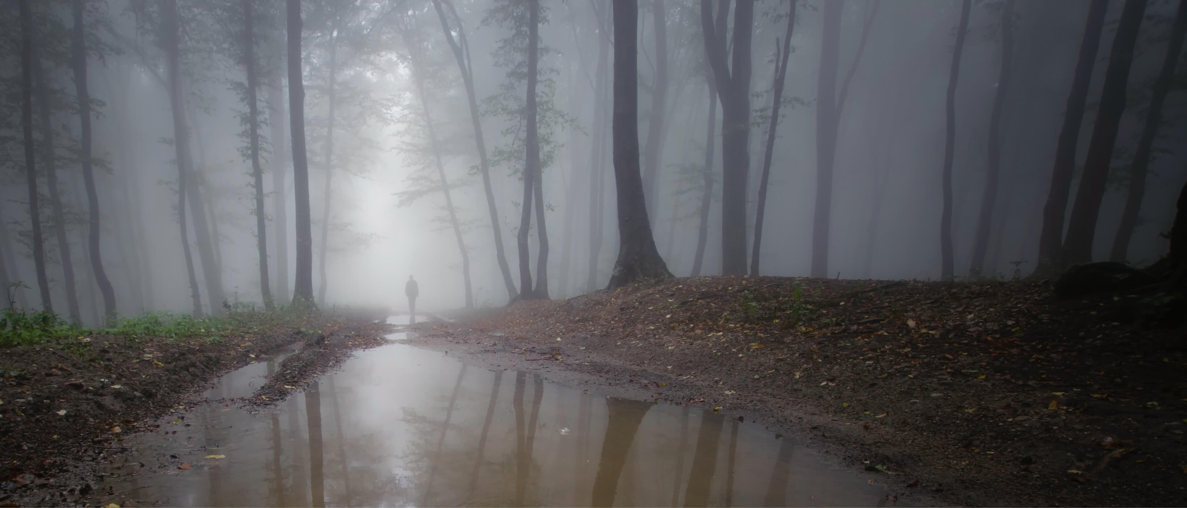
What is the Definition of an Ephemeral Stream?

Ephemeral Streams are features that only flow in direct response to precipitation events. 

These waters typically do not have a well-defined channel and are comprised of stormflow. These streams will not be present on a project site year-round and may not display traditional characteristics attributed to permanent streams until sufficient precipitation occurs.

Because they are often not present, these waters can also be referred to as Ghost Waters. Ghost Waters flow downstream, carrying sediment and other matter. These deposits can disrupt a larger waterbody within the stream network that may host ecosystems and serve as drinking water. Additionally, organic matter and runoff from ephemeral headwater streams can severely disrupt water quality. This potential impact creates the desire for the regulation of these waters at a state and federal level. Land developers may need to identify these waters on their project sites to comply with laws and avoid environmental penalties.

Where are Ephemeral Streams?

Ephemeral streams are typically in arid or semi-arid regions, such as Arizona or New Mexico, and make up most streams within these regions. In these climates, called "drylands," the evapotranspiration rate exceeds the precipitation rate, explaining their precipitation-dependent existence. These freshwater streams can contribute to surface water and stream flow only during these times of precipitation, always leaving them shallow and above the groundwater reservoir. Due to this, these waters are present for a short duration. During these dry periods, the stream may present as a dry streambed.  There is typically a higher prevalence of flora surrounding these streams when compared to the uplands of the region. During times of significant precipitation, the groundwater table can raise, and extra water is absorbed by these plants or the surrounding floodplain.

Many ephemeral streams can go unnoticed because they are not as pronounced as other types of streams, such as an intermittent stream or a perennial stream. The flow regime of these streams serves as the distinction between these waters.  Streams are considered intermittent when portions of the stream continuously flow throughout some of the year with alternating legs that may be dry (i.e. intermittent flow). These streams (sometimes called a seasonal stream or intermittent rivers) rely on seasonal changes for their water source, such as snowmelt, to create their flow. These waters still yield significantly less stream flow than perennial streams, which are considered "permanent." A perennial stream flows consistently year-round. The stream bed rests at a lower elevation than the adjoining groundwater, allowing for easy, consistent water discharge into the stream. All of these streams and their tributaries contribute to our water supply and can impact other waters.

How are Ephemeral Streams Identified?

Ephemeral streams are typically identified during initial environmental due diligence for a site. During due diligence, an environmental consultant is trained to look for features such as ephemeral stream channels. These consultants search for environmental red flags on a project site. These consultants will use tools such as a camera, small net, GPS, soil auger, and device to record their data to identify these streams. Most recommend that the identification process occurs 48 hours after the most recent rainfall.

Streams are identified by their impacts and characteristics relating to:

  • Hydrologic processes (ex. Evaporation rate)

  • Geomorphic/physical processes (ex. Channel and bank presence and definition)

  • Biological processes (ex. Flora and fauna present)

In many states, each attribute relating to the process mentioned above is scored as being:

  • Strong- Easily observed characteristic, nearly no searching required 

  • Moderate- Must search for a few minutes (under 10) to observe the characteristic

  • Weak- Must search for 10 minutes or more to observe the characteristic 

  • Absent- An unobservable characteristic

When the sources for features such as channel prevalence, continuous bend, or the soil texture are totaled, the resulting score places the stream as perennial, intermittent, or ephemeral. 

Many states may have variations to this process depending upon their requirements for stream classification. For example, Texas defines ephemeral waters as flowing water for <30% of the time, while other literature classifies a stream as ephemeral when the flow is <10% of the time.

Elevation

Ephemeral waters remain above the water table year-round, lacking any stream gradient. This factor results in the dry beds relying on precipitation for their source of flow rather than the surrounding groundwater.

Lack of a Clear Channel

Due to their inconsistent ephemeral flow, geomorphic processes have not been defined by the ephemeral stream channels—resulting in dry, flat ground instead of a stream bed. Permanent streams have an obvious definition in their stream channel, making their predictability of prevalence within a region and identification simple.

Rooted Streambeds and Vegetation

As these streams are in regions of limited moisture, local flora and fauna are typically near these streams. The vegetation, called riparian vegetation, directly surrounding the beds will appear more developed and denser than surrounding areas. Additionally, the prevalence of rooted plants indicates that this streambed belongs to an ephemeral stream as waters with a continuous flow do not allow the development of vegetation such as this.

DevArea-FogVolumeEnv01 (1)

Free Permitting Checklist

Practical Tips to Avoid Environmental Risk on all Your Projects

Download our environmental permitting checklist to get a step-by-step list of ways to protect your project from the 9 most common environmental risks.

Download Your Checklist

Are Ephemeral Streams Protected by the Clean Water Act?

The scope of jurisdictional waters, waters protected by regulation, has been under debate since the establishment of the Clean Water Act (CWA). The act mentions protection for the Waters of the United States (WOTUS) but does not provide a clear definition for these waters. This vague language has led to the definition of WOTUS changing with different presidential administrations. The protection of ephemeral waters is at the center of these debates. 

WOTUS is currently interpreted under the pre-2015 ruling, which encompasses protection for ephemeral waters. 

In the 2015 Clean Water Rule, the Obama administration established the defined WOTUS as:

  • Traditional navigable waters

  • Interstate waters

  • Territorial seas

  • Impoundments of jurisdiction in WOTUS- streams and ditches seen as having a "significant nexus" on the traditionally defined waters above 

Though a comprehensive ruling with protection for ephemeral streams, this ruling was criticized for excluding some waterways and ditches. Under this ruling, a Section 404 permit is required by developers before discharging fill material into WOTUS.

Following this ruling in 2020, President Trump altered the defined WOTUS under the Navigable Waters Protection Rule (NWPR), limiting protection to:

  • Intermittent streams and perennial streams that contribute to surface water

  • Navigable waters 

  • Territorial seas

  • Traditional interpretations of the word "waters" such as lakes, ponds, oceans, rivers, streams, ponds, and adjacent wetlands

The NWPR negated protection for ephemeral waters as it did not consider the impact on downstream waters a significant nexus. 

This ambiguity of interpretation led the Environmental Protection Agency (EPA) to call for a clear definition of the WOTUS in 2021. Their goal is to further environmental protection while maintaining regulation across administrations to avoid confusion in the development process. Many individuals expect this ruling to offer concrete answers to the questions "What is an ephemeral stream?" and "What are the WOTUS?". By doing this, permit needs will be consistent and clear for future developments. 

Why Are Ephemeral Streams Important for Land Developers?

As these protected waters are defined, developers will see an impact when selecting their project site and looking for a buildable area within a plot of land. Features such as protected wetlands or streams are environmental hurdles that can cost developers time and money.

The defined WOTUS determines when a permit is required for developers, and the U.S. Corps of Engineers oversees this permitting process. Should ephemeral waters continue to be protected as part of the defined WOTUS, missing them in due diligence can drastically impact project budgets. These Ghost Waters are not as easily found as a river, lake, or even isolated wetlands and could be overlooked by a project developer. Should these waters be missed in these initial due diligence steps, permits and recovery efforts may lead to expensive project costs and potentially deem a site undevelopable in some instances.

The permits required for development have changed as each administration alters the protection for ephemeral waters. Once needed under the Clean Water Rule, many permits were no longer required under Trump's 2020 Navigable Waters Protection Ruling. Should this ruling change once again, permits for interacting with ephemeral waters may once again be required. This change could lead to longer development timelines to fulfill the environmental due diligence and permitting approval process. The addition of time can impact the project budget and lead to expensive repercussions if the steps taken do not comply with newly introduced regulations. 

How You Can Locate or Map Ephemeral Streams?

Ephemeral streams are recorded over time but require constant reevaluation. Due to their temporary flow and lack of sufficient data, intermittent and ephemeral streams tend to be difficult to predict. 

To locate these streams, consultants use the traditional identification methods mentioned prior. Their instance is recorded onto regional, statewide, or national level maps recording their likelihood to appear. Commonly, these streams are classified via the U.S. Geological Survey (USGS) Quadrangle "blue line" maps. On these maps, the streams are classified by the following:

  • Solid line: perennial stream

  • Broken line: intermittent stream

  • Contour patterns and hydrology knowledge used to infer the location of ephemeral streams from the map

However, the "blue line" method often shows inaccuracies. Other predictive models such as recording watershed property data are becoming more common for mapping.

An alternative to the traditional mapping methods uses remote sensing technology, capturing spatial data to predict instances of these waters. This method uses factors such as vegetation presence and vegetation density as indicators for the occurrence of these features

Tools for Ephemeral Stream Mapping

Environmental due diligence software such as Transect uses machine learning to automate the mapping of ephemeral waters. This software uses prior precipitation trends and current data about ephemeral stream locations to assess a specified region. Transect's dataset provides the likelihood of a Ghost Water appearing on a site and includes a corresponding confidence level. This mapping tool can be used to select the right site for a project or to discover a buildable area within a given plot. As climate change continues to alter stream predictability, it is important to rely on data that is updated.

Free Permitting Checklist

Practical Tips to Avoid Environmental Risk on all Your Projects

Download our environmental permitting checklist to get a step-by-step list of ways to protect your project from the 9 most common environmental risks.

Download Your Checklist