
Waters & Wetlands Inventory Map
Free Permitting Checklist
Practical Tips to Avoid Environmental Risk on all Your Projects
Download our environmental permitting checklist to get a step-by-step list of ways to protect your project from the 9 most common environmental risks.
Download Your Checklist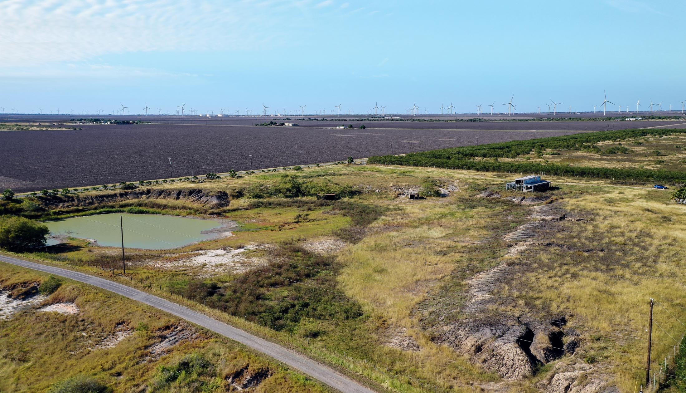
Waters and Wetlands Inventory Mapping
Waterways and wetlands are vital elements of the natural world. They provide a home for many species, drinking water, and so forth. These features can be a significant risk on a project site if not adequately addressed.
Definition of Waterways
Waterways ('waters') include oceans, bays, rivers, streams, creeks, and canals. These can be wet year-round (perennial), wet seasonally (intermittent), or wet only after storm events (ephemeral).
Definition of Wetland
Wetlands are areas inundated or saturated by surface or groundwater, often enough to support a particular combination of hydric soils and hydric plants. However, they may not be wet year-round. Wetlands include swamps, marshes, bogs, vernal pools, or mangrove forests.
The Importance of Waters and Wetlands Mapping for Site Selection
Because there are federal and state laws that protect waterways and wetlands, and those laws often trigger lengthy permitting timelines, it is crucial to know as soon as possible if these features are present in your proposed project. Local governments can also create regulations that protect waters. A wetland may not be obvious as it may not have visible surface water, so using tools and experts is crucial. Protected features can cause costly recovery costs or completely derail a project. By finding the location of wetlands and other features early in the site-selection process, developers can avoid these project timeline impacts.
Read on to learn more about how you can use wetlands mapping to assess waterways and wetlands to achieve project success.
Clean Water Act Protection for Waters & Wetlands
The Clean Water Act (CWA) is the main federal law protecting waterways and wetlands in the U.S. This act outlines the definition and regulation for waters of concern. The sections of the act that most commonly affect development projects are as follows:
CWA Section 401
This section requires proposed projects to obtain state water quality certification before construction. Most states have blanket certifications that allow projects to build without individual accreditation if they don't exceed certain pollutant thresholds.
CWA Section 402
Section 402 applies to most new construction projects that will have land disturbance greater than one acre. Section 402 regulates potential water pollution caused by "point source" runoff locations like pipes, ditches, channels, tunnels, conduits, or containers usually found on active construction sites. A section 402 permit is required when these activities occur on a project site.
CWA Section 404
Section 404 of the clean water act requires proposed construction projects to obtain a section 404 permit from the U.S. Army Corps of Engineers (USACE) before placing any dredged or fill material into "jurisdictional" waters and wetlands.
Learn more about jurisdictional waters and the Clean Water Act here
.jpg?width=1000&name=WRP_wetlands_restoration_and_John_Purviance%2c_soil_conservation_technician._(24816984600).jpg)
What are the State Regulations that Protect Waters & Wetlands?
In addition to permitting requirements under Section 404 of the Clean Water Act, 27 states have parallel or additional permitting authority for impacts to their state's waterways and wetlands. State permits are typically required in addition to federal Clean Water Act permitting, except in Michigan and New Jersey, where federal authority under the Clean Water Act Section 404 has been turned over entirely to the state.
Looking for more? Learn about state and local permitting here
How to Find Protected Waters & Wetlands Near Me
There are several ways to identify waterways and wetlands, such as traditional environmental due diligence via environmental consulting or wetland mapping tools. Two critical federal datasets tell us where waterways and wetlands could occur within a specific geographic area - these are the USGS National Hydrography Dataset map viewer and the National Wetlands Inventory map (NWI) from USFWS, respectively. Environmental consultants and online due diligence tools alike use these datasets.
Diligence tools such as the National Wetlands Inventory or the USGS National Hydrography Dataset are also available for developers to view recorded national wetlands. Datasets like these and wetlands mapping are crucial for developers to ensure efficient site selection and project planning.
National Wetlands Inventory Map
The U.S. Fish and Wildlife Service wetlands mapper tool uses digital maps and environmental data to show locations of wetlands and their extent according to a biological wetland definition. This tool serves as an extensive U.S. wetlands map. However, this tool is not a fully comprehensive due diligence tool as it does not provide permitting and regulatory information to provide a detailed protected wetlands map. This can be found at fws.gov.
National Hydrography Dataset
This data represents and depicts the nation's water drainage network. Software platforms use this data, which is available for download by the public. As the USFWS source, this tool does not outline permits needed, the jurisdiction of waters, and other regulations.
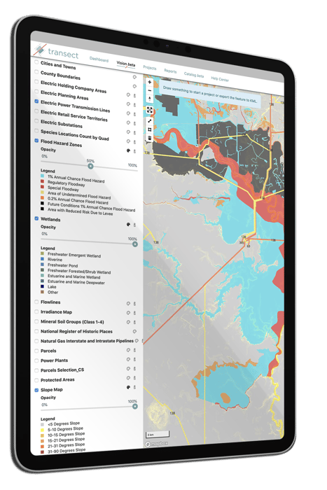
Transect’s Waters & Wetlands Map
Identifying wetlands on the National Wetland Inventory and National Hydrography Dataset can be done through Transect. This tool acts as your development's early-stage online wetlands specialist and facilitates environmental due diligence via wetland identification and wetland mapping. Developers can see a protected wetlands map for their site and cross-reference it with the permits required for their project provided through the Transect Report tool.
Transect generates a site-specific report regarding your project's environmental red flags, overall concern levels, and required permits using the USGS National Hydrography Dataset and many other national data sources. You can map the waterways and wetlands on your project using the polygon tool and populate a list of known regulations, required permits, and approximate permit timelines for your site, to ensure efficient environmental regulatory compliance. Transect's site selection feature provides you with a multi-layer map with the approximate locations of wetlands, watersheds, other resources, species of concern, protected land, cultural resources, and infrastructure to consider.
Other Mapping Solutions
GIS solutions, such as Google Earth or ESRI ArcGIS can be effective in finding wetlands on a property, but like the National Wetlands Inventory Map, these GIS tools will not outline permit needs, jurisdiction, and other regulations that could hinder your project.
How to Get a Clean Water Act Permit
Getting a waters or wetlands permit is usually not the most expensive part of a development project, but it can cost your project schedule months of delay if not prepared. Proper site selection and environmental compliance are the best tools for project success regardless of the types of land use. Follow the steps below to ensure that your project is ready to navigate wetlands permitting.
Phase 1: Environmental Due Diligence
-
As early as possible in your planning process, review waterways and wetlands maps to find the locations of wetlands in your project area. It's also prudent to review maps for critical information on protected species habitat, wetlands data, contours, protected areas, and other environmental constraints. This process helps you avoid a surprise from a potential environmental risk on your project site. Due diligence can occur during the site selection process and early stages of development. Land Developers can perform this step via environmental consultants or online due diligence tools.
-
Create a rough site plan or route, avoiding and minimizing the placement of fill or dredging in waters or wetlands
-
Research what permits are required in your state to draft the project schedule.
Phase 2: Execution
-
If you know your project footprint impacts waters or wetlands, contact a local wetlands specialist or someone specializing in environmental consulting to delineate the extent of wetlands near the impact areas, what wetland types are present, and document other important characteristics. This could include a soil survey. The acreage amount and accessibility or the land in question will dictate cost and will instruct on which permits and mitigation are required.
-
Concurrent with the wetland delineation, you will also need to contact an archaeologist to look for any sensitive cultural sites at the water impact location and a biologist to survey the area for any protected species or their deepwater habitat identified as part of Step 1.
-
Typically, the same wetlands specialist that did the field delineation will also prepare the wetland permit application for you and coordinate with the applicable federal and state permitting agencies.
-
After submission, you can expect at least 1-2 rounds of comments from the agency, in addition to negotiations around mitigation, if impacts were significant enough to require it.
-
If there were any impacts to protected species or sensitive cultural sites, coordination with U.S. Fish and Wildlife and the State Historic Preservation Office (SHPO), respectively, will also occur concurrently with the wetlands permit review.
-
If a permit requires public review and comment, that will occur towards the end of the permitting timeline.
-
Permit timelines vary, but eventually, you'll get your permit! (Fun fact: the USACE approves 99% of applications they receive)
-
During the construction and operation of your project, make sure to abide by any avoidance or conservation measures detailed in the permit.
DID YOU KNOW? Transect Reports will map the waterways and wetlands on your project and populate a list of known regulations, required permits, and approximate permit timelines for your site, taking the guesswork out of your project planning.