
Wetland Delineation
Free Permitting Checklist
Practical Tips to Avoid Environmental Risk on all Your Projects
Download our environmental permitting checklist to get a step-by-step list of ways to protect your project from the 9 most common environmental risks.
Download Your Checklist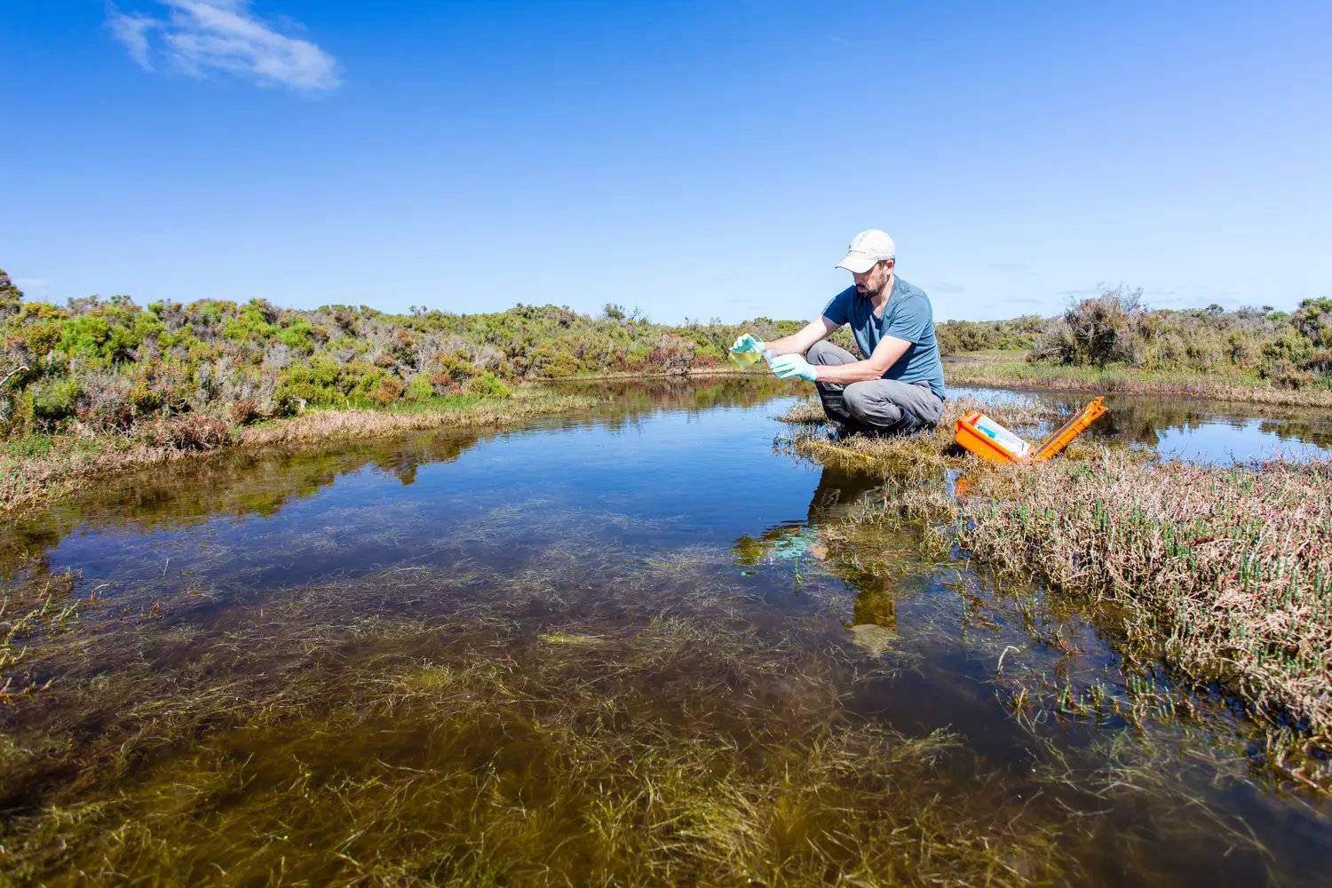
Why Wetlands are Protected: The Clean Water Act and Water Quality Protections
Wetlands are an essential part of ecosystems and help maintain water quality, aid in flood control, and provide habitat for various animal and plant species. Wetlands in the upper reaches of a watershed often provide the greatest ecological and water quality value.
Wetland Boundaries and Jurisdictional Determination: Waters of the United States
Wetlands are given protection under the Clean Water Act as they are part of the Waters of the United States (WOTUS.) Protection of wetlands helps provide quality drinking water, species habitat, and other features of value. In addition to federal regulation, many states hold their own wetlands protections. State-specific wetland regulation often means that a development project may require additional regulations and permits.
When to Do a Wetland Delineation
Wetland delineations are required when developing a project, draining an agricultural field, or building a new road that may impact a wetland. This process is legally required when a wetland is found on a property that is planned for development, could be affected, and can severely delay a project if not properly completed. The U.S. Army Corps of Engineers and local regulatory agencies must approve the wetland boundary to receive a permit to impact regulated wetlands.

How to Conduct Wetland Delineation
Hire a Wetland Professional
A wetland professional, such as an environmental consultant or another qualified specialist, will assess a project to determine the presence of a wetland. They can inform land developers about the permits required and potential environmental risks on their project site. This is part of the natural resources environmental due diligence process, which usually takes weeks to months to complete.
Ordering a Wetland Delineation from Transect's Services Marketplace can save time and move projects along faster.
National Wetlands Inventory
This USFWS tool uses wetlands data to map wetlands. Developers can access this tool to see if there may be a wetland on their site and the potential boundary of this wetland. This tool may provide limited information, and additional research may be required. This tool may be best for site selection and the initial determination of a wetland’s presence.
Due Diligence Software
Environmental due diligence software, such as Transect, use the National Wetlands Inventory dataset to identify wetlands and other protected features. This tool can provide the location and data regarding protected species, waters, and other features specific to a site that could present a challenge for development. Additional research may be required after the initial presence of critical natural resources is determined.
How Long is My Wetland Delineation Good For?
A wetland delineation is good for five years post-approval. Proper timing of this process can help developers avoid additional costs to their project by having to prematurely re-do this process.
What is Wetland Reconnaissance?
Wetland Reconnaissance is the general assessment used to determine if a protected wetland feature is present on a property. A report shows the absence of the feature for use in the permitting process. Should a wetland be found, a wetland delineation is required.
What is the Difference Between Wetland Delineation and Wetland Reconnaissance?
Wetland Delineation is legally required when protected waters are on a property. This process is a detailed study and written report of these protected waters, outlining the features’ boundaries and wetland types. A wetland delineation is performed in accordance with the 1987 US Army Corps guidelines. The deliverables of a wetland delineation will include the GPS map with the wetland boundaries, the wetland determination information, and a formal report for the permitting process.
Wetland Reconnaissance is used to determine if protected features are present. The reconnaissance is a preliminary evaluation tool that helps screen properties for land development. Wetland reconnaissance is valuable during the site selection process.
How Much Does Wetland Delineation Cost?
A traditional wetland delineation can cost $700-$850 for a project on less than 5 acres and $15,000-$25,000 on larger sites. This range varies on the property's acreage, region of the country, site conditions, and consulting company.
What is Wetland Mitigation?
Wetland mitigation is creating, restoring, or enhancing a wetland to make up for losses due to land disturbance, including development. Wetland mitigation is typically used to prevent significant impacts to highly sensitive or rare wetland systems or large wetland impacts.
The 1975 Farm Bill added protections to the original CWA scope to limit the conversion of wetlands for agricultural use. To discourage these actions, some USDA benefits were withheld until the loss of these regions was compensated. These mitigation actions are required by Clean Water Act Section 404 when destroying a wetland. Once these mitigation plans have been established, they must receive the approval of the Natural Resources Conservation Service (NRCS.)